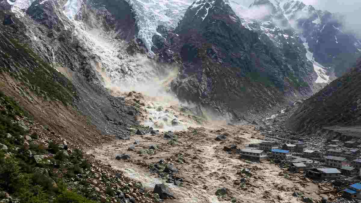
A disaster that initially appeared to be linked to an earthquake has now been traced to a dramatic collapse high in the Himalayas. At an altitude of about 5,200 metres above sea level, a massive section of glacier suddenly broke away and plunged roughly 1.2 kilometres into the valley below.
The impact set off a chain of events that transformed a remote mountain river into a violent torrent carrying ice, rocks, mud and trees. Within minutes, the destructive flow surged through the river corridor along the Nepal Tibet border, causing widespread devastation downstream.
Scientists examining satellite imagery and seismic data have now pieced together how the event unfolded. Their findings indicate that the sudden disaster was driven by a huge glacier collapse rather than a conventional earthquake.
Satellite Images Reveal the Scale of the Glacier Collapse:
Daniel Shugar, a geomorphologist at the University of Calgary in Canada, studied imagery from Planet Labs to reconstruct the event. His analysis indicates that a glacier covering an area of around 200 square metres suddenly broke apart, with roughly two thirds of its main section separating from the larger mass.
The broken glacier plunged into the Lende Khola river basin from a vertical depth of about 1.2 kilometres. The enormous gravitational energy generated during the fall converted the collapsing ice into a powerful moving mass.
As the ice crashed downward, it fragmented and gathered material from the surrounding landscape. Rocks, soil and other debris were swept into the flow, turning what began as an ice collapse into a much larger debris flow.
Simon Cox, a principal scientist at New Zealand Earth Sciences, assessed the event as a cascading process in which the falling glacier interacted with the unstable terrain below.
Satellite observations provided an important record of the transformation. A Sentinel 2 image captured on August 24 showed the glacier appearing largely intact. An image from Landsat 9 taken on August 26, after the disaster, showed that about two thirds of the glacier had disappeared.
The affected section left behind a large horseshoe shaped scar across the glacier. Seismic observations also helped investigators determine what had happened. Although the initial assumption was that an earthquake had caused the destruction, the recorded ground vibrations were instead consistent with the impact generated by the collapsing glacier.
The falling mass did far more than simply enter the river. Its combination of ice, rocks, soil and mud dramatically altered the character of the waterway.
How Ice and Rock Turned Into a Powerful Debris Flow:
Hydrologist Hatem Sharif of the University of Texas compared the resulting mixture to liquid concrete. Unlike ordinary floodwater, a dense flow packed with mud and large rocks can carry enormous destructive force, sweeping away bridges, buildings and heavy vehicles along its path.
The debris temporarily blocked the Lende Khola river, effectively forming a natural barrier. Water accumulated behind the blockage until the temporary obstruction gave way.
Once that barrier failed, the accumulated water and debris rushed downstream towards settlements along the Bhote Koshi and Trishuli corridor. The sudden release left communities in the path of the flow with very little time to respond.
The event also highlights a wider concern surrounding the stability of the Himalayan region. A similar cascading disaster occurred in Uttarakhand’s Chamoli district in 2021, when a combination of glacier material and a landslide descended from Ronti Peak and caused catastrophic flooding in the Rishiganga river.
Scientists have increasingly focused on how rising temperatures can affect the stability of high altitude glaciers and surrounding mountain slopes. Changes within glaciers, including melting and weakening, can create conditions in which a relatively sudden collapse triggers a much larger sequence of events.
The Nepal disaster demonstrates how an event that begins thousands of metres above inhabited areas can rapidly develop into a major threat far downstream. It also underlines the importance of satellite observation and effective early warning systems in mountainous regions, where detecting instability in remote and inaccessible terrain can be extremely difficult.